Imachen:BlankEurope.png

Grandaria d'ista previsualización: 595 × 599 pixels. Atras resolucions: 238 × 240 pixels | 477 × 480 pixels | 762 × 768 pixels | 1236 × 1245 pixels.
Fichero orichinal (1236 × 1245 píxels; grandaria d'o fichero: 78 kB; tipo MIME: image/png)

|
File:Blank map of Europe (with disputed regions).svg es una versión vectorial de este archivo. Debería usarse esa versión en lugar de este archivo PNG, cuando sea mejor.
File:BlankEurope.png → File:Blank map of Europe (with disputed regions).svg
Para más información, lee Ayuda:SVG. |
.svg) |
Resumen
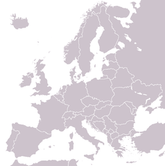
A blank political map of Europe extracted from Image:European Union member states by number of houses.png. +Hexagon1 (t) 04:47, 26 November 2006 (UTC)
Other versions: if you wish to use a map to show historical information before 2008, use Image:BlankEurope-BeforeKosovo.png
Licenciando

|
Se gosa premetir a copia, a destribución y a modificación d'iste decumento baixo d'os termins d'a licencia de decumentación libre GNU, Versión 1.2 u qualsiquier altra versión posteriorment expublicata por a Free Software Foundation; sin de seccions invariaderas (Unvariant Sections), textos de portalada (Front-Cover Texts), ni textos de contraportalada (Back-Cover Texts). S'enclui una copia d'ista licencia en anglés en l'articlo GNU Free Documentation License". |
| Iste fichero se troba baixo a licencia Creative Commons Chenerica d'Atribución/Compartir-Igual 3.0. | ||
| ||
| Ista etiqueta de licencia fue adhibida a iste fichero como parte d'a actualización d'a licencia GFDL. |
Historial d'o fichero
Punche en una calendata/hora ta veyer o fichero como amaneixeba por ixas envueltas.
| Calendata/Hora | Miniatura | Dimensions | Usuario | Comentario | |
|---|---|---|---|---|---|
| actual | 13:31 26 set 2022 | | 1236 × 1245 (78 kB) | BlackShadowG | Reverted to version as of 14:55, 27 October 2008 (UTC) |
| 22:40 23 feb 2009 |  | 1236 × 1245 (78 kB) | Avala | ||
| 14:55 27 oct 2008 |  | 1236 × 1245 (78 kB) | Quilbert | Reverted to version as of 05:53, 5 April 2008 – there is already Image:BlankEurope-BeforeKosovo.png | |
| 18:13 24 oct 2008 |  | 1236 × 1245 (78 kB) | Avala | ||
| 05:53 5 abr 2008 |  | 1236 × 1245 (78 kB) | Hoshie | redid microstates, beefed up Spanish N. Africa, SBAs, and Gibraltar | |
| 18:42 25 feb 2008 |  | 1236 × 1245 (78 kB) | Hoshie | fixed Gibraltar, Ceuta and Melilla, and the SBAs | |
| 02:39 24 feb 2008 |  | 1236 × 1245 (78 kB) | Hoshie | Added Kosovo since it has been internationally recognized | |
| 22:40 3 chi 2008 |  | 1236 × 1245 (78 kB) | Hoshie | Re-drew ESBA and WSBA with circles until I study the CIA maps, boundary between Gibraltar and Spain. | |
| 04:47 26 nov 2006 |  | 1236 × 1245 (44 kB) | Happenstance | A blank map of Europe extracted from Image:European Union member states by number of houses.png. ~~~~ |
Uso d'o fichero
Garra pachina tiene un vinclo ta iste fichero.
Uso de fichers globals
Os siguients wikis fan servir iste fichero:
- Uso en de.wiktionary.org
- Uso en hu.wikipedia.org
- Uso en incubator.wikimedia.org
- Uso en it.wiktionary.org
- Uso en sl.wiktionary.org
- Uso en uk.wikipedia.org