Imachen:VietnameseProvincesMapTiengViet.png
Grandaria d'ista previsualización: 360 × 600 pixels. Atras resolucions: 144 × 240 pixels | 428 × 713 pixels.
Fichero orichinal (428 × 713 píxels; grandaria d'o fichero: 45 kB; tipo MIME: image/png)
Resumen
| Descripción |
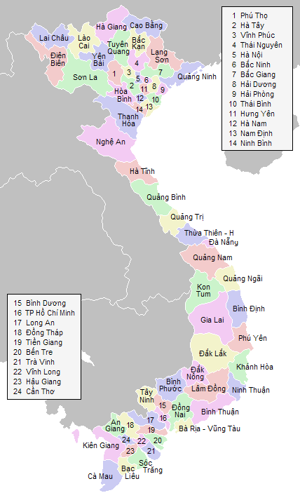
English: Labeled map of Vietnamese provinces |
| Fuent | Treballo de qui la cargó |
| Autor | Vardion |
Licenciando

|
Se gosa premetir a copia, a destribución y a modificación d'iste decumento baixo d'os termins d'a licencia de decumentación libre GNU, Versión 1.2 u qualsiquier altra versión posteriorment expublicata por a Free Software Foundation; sin de seccions invariaderas (Unvariant Sections), textos de portalada (Front-Cover Texts), ni textos de contraportalada (Back-Cover Texts). S'enclui una copia d'ista licencia en anglés en l'articlo GNU Free Documentation License". |
| Iste fichero se troba baixo a licencia Creative Commons Chenerica d'Atribución/Compartir-Igual 3.0. | ||
| ||
| Ista etiqueta de licencia fue adhibida a iste fichero como parte d'a actualización d'a licencia GFDL. |
Historial d'o fichero
Punche en una calendata/hora ta veyer o fichero como amaneixeba por ixas envueltas.
| Calendata/Hora | Miniatura | Dimensions | Usuario | Comentario | |
|---|---|---|---|---|---|
| actual | 07:40 30 ago 2018 | | 428 × 713 (45 kB) | 4nn1l2 | Reverted to version as of 23:28, 20 January 2006 (UTC) COM:OW |
| 02:48 30 ago 2018 |  | 1621 × 2000 (6,86 MB) | H.V.T Pro-4 | Merge "Hà Tây" into "Hà Nội" | |
| 23:28 20 chi 2006 |  | 428 × 713 (45 kB) | Vardion | more corrections | |
| 23:15 20 chi 2006 |  | 428 × 713 (45 kB) | Vardion | hopefully including both corrections on the same map... | |
| 23:11 20 chi 2006 |  | 428 × 713 (45 kB) | Mxn | Reverted to earlier revision | |
| 23:10 20 chi 2006 |  | 428 × 713 (45 kB) | Mxn | Reverted to earlier revision | |
| 22:52 20 chi 2006 |  | 428 × 713 (45 kB) | Vardion | spelling | |
| 21:59 20 chi 2006 |  | 428 × 713 (45 kB) | Vardion | correcting boundary between Dien Bien and Lai Chau provinces | |
| 21:52 15 chun 2005 |  | 428 × 713 (45 kB) | Vardion | Labeled map of Vietnamese provinces. Made for Wikipedia by uploader. {{GDFL}} |
Uso d'o fichero
A pachina siguient emplega iste fichero:
Uso de fichers globals
Os siguients wikis fan servir iste fichero:
- Uso en bg.wikipedia.org
- Uso en en.wikipedia.org
- Uso en fr.wikipedia.org
- Uso en he.wikipedia.org
- Uso en hu.wikipedia.org
- Uso en id.wikipedia.org
- Uso en tg.wikipedia.org
- Uso en tl.wikipedia.org
- Uso en tr.wikipedia.org
- Uso en vi.wikipedia.org