Imachen:Satellite image of Flevopolder, Netherlands (5.48E 52.43N).png

Grandaria d'ista previsualización: 800 × 548 pixels. Atras resolucions: 320 × 219 pixels | 640 × 439 pixels | 1024 × 702 pixels.
Fichero orichinal (1024 × 702 píxels; grandaria d'o fichero: 1,49 MB; tipo MIME: image/png)
.png)
| Descripción |
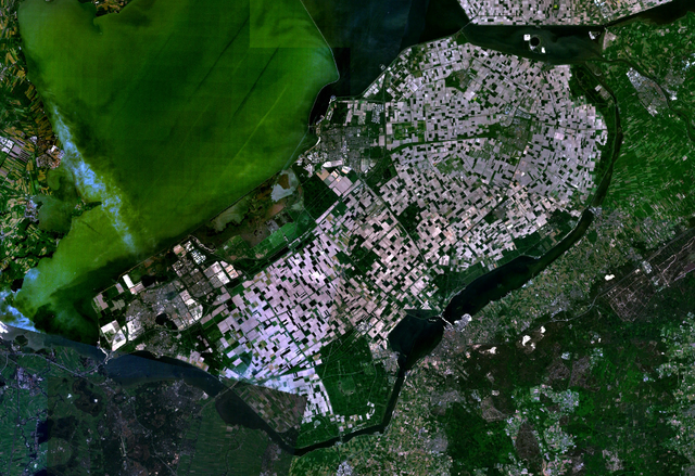
English: Satellite image of the Flevopolder in the Netherlands. Technically, the Flevopolder consists of Zuidelijk Flevoland (Southern Flevoland), Oostelijk Flevoland (Eastern Flevoland) and the Noordoostpolder (North Eastern Polder). This image shows Southern and Eastern Flevoland. |
| Fuent | Screenshot from NASA's World Wind |
| Autor | Foto: NASA |
| Esta imagen se encuentra en el dominio público porque es una captura de pantalla del software de globo terráqueo de la NASA, World Wind, que utiliza una capa de dominio público, como Blue Marble, MODIS, Landsat, SRTM, USGS o GLOBE.
|
 |
Historial d'o fichero
Punche en una calendata/hora ta veyer o fichero como amaneixeba por ixas envueltas.
| Calendata/Hora | Miniatura | Dimensions | Usuario | Comentario | |
|---|---|---|---|---|---|
| actual | 13:25 4 may 2005 | | 1024 × 702 (1,49 MB) | Galwaygirl | Satellite image of the Flevopolder in the Netherlands. Screenshot from NASA's World Wind {{PD}} |
Uso d'o fichero
A pachina siguient emplega iste fichero:
Uso de fichers globals
Os siguients wikis fan servir iste fichero:
- Uso en ar.wikipedia.org
- Uso en ast.wikipedia.org
- Uso en br.wikipedia.org
- Uso en ca.wikipedia.org
- Uso en cs.wikipedia.org
- Uso en da.wikipedia.org
- Uso en de.wikipedia.org
- Uso en el.wikipedia.org
- Uso en en.wikipedia.org
- Uso en es.wikipedia.org
- Uso en eu.wikipedia.org
- Uso en fa.wikipedia.org
- Uso en fr.wikipedia.org
- Uso en gl.wikipedia.org
- Uso en he.wikipedia.org
- Uso en hr.wikipedia.org
- Uso en hy.wikipedia.org
- Uso en id.wikipedia.org
- Uso en kk.wikipedia.org
- Uso en ko.wikipedia.org
- Uso en ms.wikipedia.org
- Uso en nl.wikipedia.org
- Uso en no.wikipedia.org
- Uso en oc.wikipedia.org
- Uso en ro.wikipedia.org
- Uso en ru.wikipedia.org
- Uso en sh.wikipedia.org
- Uso en simple.wikipedia.org
- Uso en sr.wikipedia.org
Veyer mas información sobre l'uso global d'iste fichero.
.png)
.png)