Imachen:Poland 1956-1990.svg

Tamaño de esta previsualización PNG del archivo SVG: 450 × 456 pixels. Atras resolucions: 237 × 240 pixels | 474 × 480 pixels | 758 × 768 pixels | 1011 × 1024 pixels | 2021 × 2048 pixels.
Fichero orichinal (fichero SVG, nominalment 450 × 456 píxels, grandaria: 474 kB)
Resumen


.svg)
.svg)
.svg)
.svg)
.svg)


.svg)
.svg)
.svg)


.png)
.png)


.svg)


.svg)

.svg)


.svg)
.svg)
.svg)
.svg)


.svg)
.png)


.svg)


.svg)
.svg)


.svg)


.svg)


.svg)
.svg)
.svg)
.svg)
.svg)
.svg)
.svg)
_cropped.svg)
.svg)
.svg)
.svg)
.svg)
.svg)
.svg)
.svg)
.svg)
.svg)
.svg)
.svg)
.svg)
.svg)
.svg)
.svg)
.svg)
.svg)
.svg)
.svg)
.svg)
.svg)
.svg)
.svg)
.svg)
.svg)
.svg)
.svg)
.svg)
.svg)
.svg)
.svg)
.svg)
.svg)
.svg)
.svg)
.svg)
.svg)
.svg)
.svg)
.svg)
.svg)
.svg)
.svg)
.svg)
.svg)
| Esta es una imagen retocada, lo que significa que ha sido alterada digitalmente de su versión original. La original se puede ver aquí: Blank map of Europe 1956-1990.svg.
|
Licenciando
Yo, o titular d'os dreitos d'autor d'ista obra, la publico en os termins d'a siguient licencia:
Iste fichero se troba baixo a licencia Creative Commons Chenerica d'Atribución/Compartir-Igual 3.0.
- Ye libre:
- de compartir – de copiar, distribuir y transmitir o treballo
- de remezclar – d'adaptar o treballo
- Baixo as siguients condicions:
- atribución d'autoría – Ha d'atribuir l'autoría d'o treballo d'a traza especificada por l'autor u persona que l'haiga licenciau (pero no pas de traza que suchiera que l'autor/os autors refirma(n) u refirma(n) l'uso que faigas d'o treballo).
- compartir igual – En caso d'alterar, transformar u enamplar iste treballo, habrá de distribuir o treballo resultant solament baixo a mesma licencia u beluna equivalent.
Rechistro orichinal de carga
This image is a derivative work of the following images:
- File:Blank_map_of_Europe_1956-1990.svg licensed with Cc-by-sa-3.0
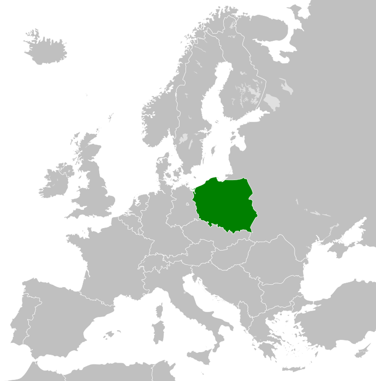
- 2011-10-30T04:43:42Z Alphathon 450x456 (485146 Bytes) == {{int:filedesc}} == {{Information |Description={{en|Blank map of Europe showing national borders as they stood from 1956-1990.}} |Source=*[[:File:Blank_map_of_Europe.svg|]] |Date=2011-10-30 04:42 (UTC) |Author=*[[:File:Bla
Uploaded with derivativeFX
Historial d'o fichero
Punche en una calendata/hora ta veyer o fichero como amaneixeba por ixas envueltas.
| Calendata/Hora | Miniatura | Dimensions | Usuario | Comentario | |
|---|---|---|---|---|---|
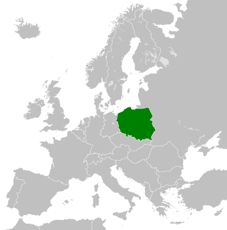
| actual | 00:23 26 nov 2011 | | 450 × 456 (474 kB) | StalwartUK | == {{int:filedesc}} == {{Information |Description={{en|Map of the People's Republic of Poland as it was from 1945-1990. Surrounding countries accurate from 1956-1990.}} |Source=*[[:File:Blank_map_of_Europe_1956-1990.svg |
Uso d'o fichero
A pachina siguient emplega iste fichero:
Uso de fichers globals
Os siguients wikis fan servir iste fichero:
- Uso en ar.wikipedia.org
- Uso en az.wikipedia.org
- Uso en ca.wikipedia.org
- Uso en cs.wikipedia.org
- Uso en de.wikipedia.org
- Uso en el.wikipedia.org
- Uso en en.wikipedia.org
- Uso en en.wiktionary.org
- Uso en eo.wikipedia.org
- Uso en es.wikipedia.org
- Uso en et.wikipedia.org
- Uso en eu.wikipedia.org
- Uso en fa.wikipedia.org
- Uso en fi.wikipedia.org
- Uso en fr.wikipedia.org
- Uso en gl.wikipedia.org
- Uso en he.wikipedia.org
- Uso en hi.wikipedia.org
- Uso en hu.wikipedia.org
- Uso en hy.wikipedia.org
- Uso en id.wikipedia.org
- Uso en it.wikipedia.org
- Uso en ja.wikipedia.org
- Uso en kk.wikipedia.org
- Uso en ko.wikipedia.org
- Uso en lt.wikipedia.org
- Uso en lv.wikipedia.org
- Uso en mk.wikipedia.org
- Uso en ms.wikipedia.org
- Uso en nl.wikipedia.org
- Uso en pl.wikipedia.org
- Rzeczpospolita Polska
- Polska Rzeczpospolita Ludowa
- Wikipedysta:KrakovHD/brudnopis
- Wikipedysta:OlafMaj1/brudnopi4
- Wikipedysta:TheTNT1500/Lista państw komunistycznych
- Wikipedysta:Malarz pl/szablony/Państwo infobox/4
- Wikipedysta:Malarz pl/szablony/Państwo infobox
- Wikipedysta:Malarz pl/szablony/Państwo infobox/26
- Uso en pnb.wikipedia.org
- Uso en pt.wikipedia.org
- Uso en ro.wikipedia.org
- Uso en rue.wikipedia.org
Veyer mas información sobre l'uso global d'iste fichero.