Imachen:Antarctica, New Zealand territorial claim.svg

Tamaño de esta previsualización PNG del archivo SVG: 600 × 600 pixels. Atras resolucions: 240 × 240 pixels | 480 × 480 pixels | 768 × 768 pixels | 1024 × 1024 pixels | 2048 × 2048 pixels | 806 × 806 pixels.
Fichero orichinal (fichero SVG, nominalment 806 × 806 píxels, grandaria: 63 kB)
| Descripción |
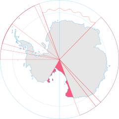
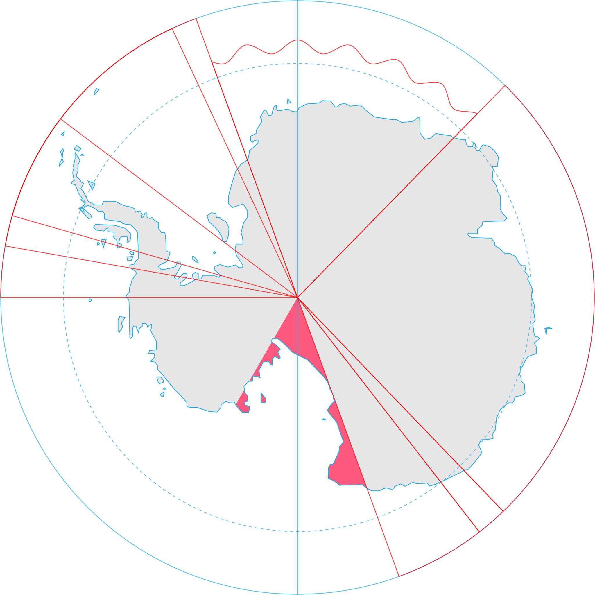
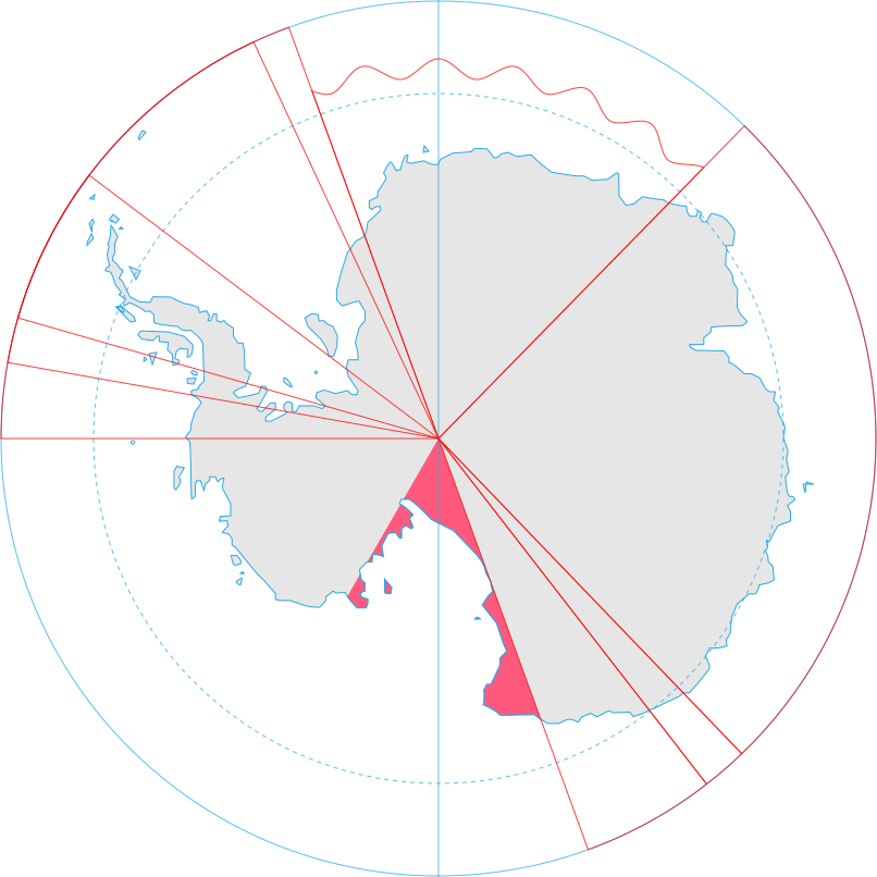
English: Map showing the territorial claim to Antarctica by the country in the filename. Also on the map are is the 60° S Parallel, Antarctic Circle, 0/180 latitude line and (in red) the borders of the claims by other states. |
| Calendata | |
| Fuent | Generated from Antarctica by Lokal_Profil. |
| Autor | Lokal_Profil |
| Permiso (Reutilización d'iste fichero) |
Iste fichero se troba baixo a licencia Creative Commons Chenerica d'Atribución/Compartir-Igual 2.5. Atribución d'autoría: Lokal_Profil
|
| Atras versions |
|
.svg)
Historial d'o fichero
Punche en una calendata/hora ta veyer o fichero como amaneixeba por ixas envueltas.
| Calendata/Hora | Miniatura | Dimensions | Usuario | Comentario | |
|---|---|---|---|---|---|
| actual | 17:09 8 may 2020 | | 806 × 806 (63 kB) | Spesh531 | Norway's claim extends south to the South Pole as of June 12 2015. Northern claim is still undefined |
| 20:55 30 chun 2008 |  | 806 × 806 (65 kB) | Lokal Profil | {{Information |Description={{en|Map showing the territorial claim to Antarctica by the country in the filename. Also on the map are is the 60° S Parallel, Antarctic Circle, 0/180 latitude line and (in red) the borders of the claims by other states.}} |So |
Uso d'o fichero
A pachina siguient emplega iste fichero:
Uso de fichers globals
Os siguients wikis fan servir iste fichero:
- Uso en af.wikipedia.org
- Uso en ar.wikipedia.org
- Uso en az.wikipedia.org
- Uso en ca.wikipedia.org
- Uso en chr.wikipedia.org
- Uso en ckb.wikipedia.org
- Uso en cs.wikipedia.org
- Uso en de.wikipedia.org
- Uso en diq.wikipedia.org
- Uso en el.wikipedia.org
- Uso en en.wikipedia.org
- Uso en es.wikipedia.org
- Uso en et.wikipedia.org
- Uso en fa.wikipedia.org
- Uso en fi.wikipedia.org
- Uso en frr.wikipedia.org
- Uso en fr.wikipedia.org
- Uso en gl.wikipedia.org
- Uso en gv.wikipedia.org
- Uso en hi.wikipedia.org
- Uso en hu.wikipedia.org
- Uso en id.wikipedia.org
- Uso en ilo.wikipedia.org
- Uso en it.wikipedia.org
- Uso en ja.wikipedia.org
- Uso en ko.wikipedia.org
- Uso en lt.wikipedia.org
Veyer mas información sobre l'uso global d'iste fichero.