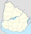
Imachen:Uruguay location map.svg

Tamaño de esta previsualización PNG del archivo SVG: 550 × 600 pixels. Atras resolucions: 220 × 240 pixels | 440 × 480 pixels | 705 × 768 pixels | 939 × 1024 pixels | 1879 × 2048 pixels | 1000 × 1090 pixels.
Fichero orichinal (fichero SVG, nominalment 1000 × 1090 píxels, grandaria: 62 kB)
Historial d'o fichero
Punche en una calendata/hora ta veyer o fichero como amaneixeba por ixas envueltas.
| Calendata/Hora | Miniatura | Dimensions | Usuario | Comentario | |
|---|---|---|---|---|---|
| actual | 05:43 16 mar 2024 |  | 1000 × 1090 (62 kB) | GrandEscogriffe | more correct north-south stretching |
| 01:43 13 chul 2016 |  | 1000 × 1056 (74 kB) | Janitoalevic | Added Rincón de Artigas and isla Brasilera disputes and fixed brazilian border in the north of the map. | |
| 14:19 10 feb 2011 |  | 1000 × 1056 (77 kB) | Antonsusi | ... | |
| 14:12 10 feb 2011 |  | 1000 × 1056 (77 kB) | Antonsusi | try again | |
| 14:10 10 feb 2011 |  | 3000 × 3168 (77 kB) | Antonsusi | repair | |
| 07:04 7 mar 2010 |  | 1000 × 1056 (114 kB) | Spischot | Default size inceased | |
| 22:26 25 oct 2009 |  | 344 × 363 (139 kB) | Spischot | {{Information |Description={{de|Positionskarte von Uruguay}} Quadratische Plattkarte, Geographische Begrenzung der Karte: * N: 29.86° S * S: 35.19° S * W: 58,71° W * O: 52,89° W {{en|Location map of Uruguay}} Equ |
Uso d'o fichero
As 2 pachinas emplegan iste fichero:
Uso de fichers globals
Os siguients wikis fan servir iste fichero:
- Uso en af.wikipedia.org
- Uso en als.wikipedia.org
- Uso en ar.wikipedia.org
- Uso en ast.wikipedia.org
- Colonia del Sacramento
- Regueru Mataojito
- Montevidéu
- Minas
- Universidá de la República
- Módulu:Mapa de llocalización/datos/Uruguái
- Módulu:Mapa de llocalización/datos/Uruguái/usu
- Palaciu Llexislativu del Uruguái
- Florida (Uruguái)
- Aguas Corrientes
- Canelones (Uruguái)
- Durazno (Uruguái)
- Trinidad (Uruguái)
- San José de Mayo
- Mercedes (Uruguái)
- Maldonado (Uruguái)
- Rocha (Uruguái)
- Treinta y Tres
- Melo
- Fray Bentos
- Tacuarembó
- Rivera (Uruguái)
- Artigas (Uruguái)
- Paysandú (Uruguái)
- Salto (Uruguái)
- Toledo (Uruguái)
- Progreso (Uruguái)
- Las Piedras (Uruguái)
- La Paz (Canelones)
- Santa Lucía (Uruguái)
- Atlántida (Uruguái)
- Barros Blancos
- Ciudad de la Costa
- Colonia Nicolich
- Empalme Olmos
- La Floresta (Uruguái)
- Los Cerrillos (Canelones)
- Migues
- Montes (Uruguái)
- Pando (Uruguái)
- Parque del Plata
Veyer mas información sobre l'uso global d'iste fichero.
